En
Log in
All resources
Create a design
Tools
7,118 Free Images of Engraved Maps
maps from the earth and its inhabitants, vol. iv
copper engraving print
british library
joan blaeu
maps from the earth and its inhabitants, vol. xiv
maps from the earth and its inhabitants, vol. xviii
maps from the earth and its inhabitants, vol. xvi
1667 maps
maps from the earth and its inhabitants, vol. xv
maps from the earth and its inhabitants, vol. xiii
atlas maior, vol 8 (france ii and switzerland) - joan blaeu, 1667 - bl 114.h(star).8
1667 maps
atlas maior, vol 7 (france i) - joan blaeu, 1667 - bl 114.h(star).7
1667 maps
atlas maior, vol 8 (france ii and switzerland) - joan blaeu, 1667 - bl 114.h(star).8
1667 maps
atlas maior, vol 4 (netherlands) - joan blaeu, 1667 - bl 114.h(star).4
1667 maps
atlas maior, vol 9 (italy) - joan blaeu, 1667 - bl 114.h(star).9
1667 maps of italy
atlas maior, vol 6 (scotland and ireland) - joan blaeu, 1667 - bl 114.h(star).6
1667 maps
atlas maior, vol 9 (italy) - joan blaeu, 1667 - bl 114.h(star).9
1667 maps of italy
maps from the earth and its inhabitants, vol. xv
maps of native american tribal territories
1840s maps of the world
german renaissance
city walls of lechenich
baroque
camps topographiques de la campagne de mdcclvii, en westphalie
stöcken (hannover)
liber qvartvs contrafactur vnd beschreibung von den vornembsten stten der welt (zzk 0.32)
patrimonium 2 (project)
engravings of topographia braunschweig lüneburg
baroque
maps from the earth and its inhabitants, vol. vii
treaty ports
atlas maior, vol 3 (germany) - joan blaeu, 1667 - bl 114.h(star).3
johannes gigas
eran laor cartographic collection
william hole (engraver)
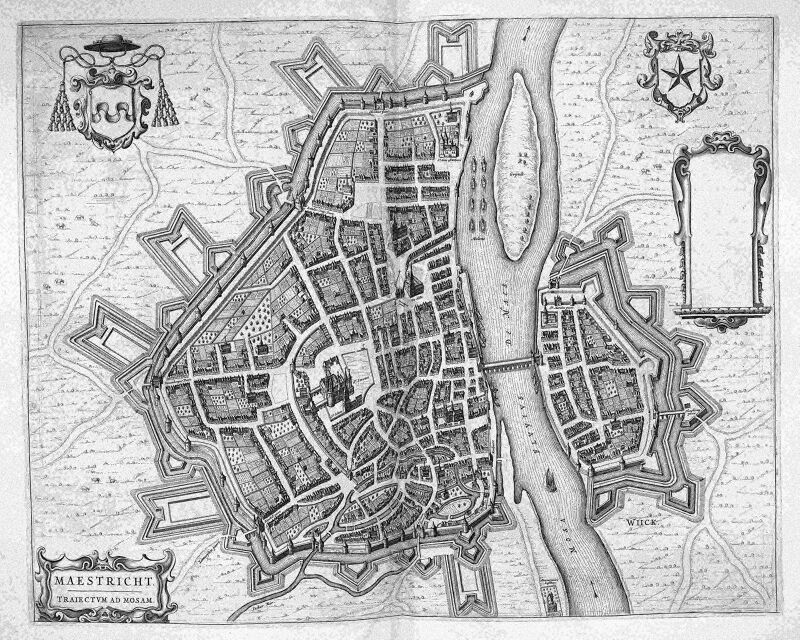
map of maastricht by willem and johannes blaeu (1649)
atlas beudeker
maps from the earth and its inhabitants, vol. xv
temperature maps of north america
maps from the earth and its inhabitants, vol. xii
19th-century maps of the azores
maps from the earth and its inhabitants, vol. xiv
old maps of sydney
maps from the earth and its inhabitants, vol. xviii
1870s maps of peru
maps from the earth and its inhabitants, vol. iv
19th-century maps of cornwall
maps from the earth and its inhabitants, vol. xvi
1870s maps of mexico
maps from the earth and its inhabitants, vol. iv
1870s maps of london
maps from the earth and its inhabitants, vol. xiii
maps indicating exploration
maps from the earth and its inhabitants, vol. xviii
old maps of valparaíso
maps from the earth and its inhabitants, vol. viii
maps of the mekong
maps from the earth and its inhabitants, vol. iv
old maps of windsor
maps from the earth and its inhabitants, vol. iv
maps of tides
19th-century maps of namibia
maps of walvis bay
maps from the earth and its inhabitants, vol. iv
maps of the humber estuary
maps from the earth and its inhabitants, vol. iv
maps of rochester, kent
maps from the earth and its inhabitants, vol. xvi
old maps of central america
maps from the earth and its inhabitants, vol. xv
hydrological maps of the united states
maps from the earth and its inhabitants, vol. v
1870s maps of finland
maps from the earth and its inhabitants, vol. xviii
maps of indigenous territories of colombia
maps from the earth and its inhabitants, vol. x
19th-century maps of the nile delta
maps from the earth and its inhabitants, vol. x
maps of lake victoria
maps from the earth and its inhabitants, vol. xii
maps of ocean currents
maps from the earth and its inhabitants, vol. xvi
maps of the mexican war of independence
maps from the earth and its inhabitants, vol. iv
1870s maps of scotland
maps from the earth and its inhabitants, vol. xviii
old maps of valparaíso
maps from the earth and its inhabitants, vol. xvi
maps of central america
maps from the earth and its inhabitants, vol. iv
maps of balmoral castle
maps from the earth and its inhabitants, vol. iv
old maps of the isle of arran
maps from the earth and its inhabitants, vol. vii
1870s maps of japan
maps from the earth and its inhabitants, vol. vii
1870s maps of china
maps from the earth and its inhabitants, vol. iii
1870s maps of switzerland
maps from the earth and its inhabitants, vol. viii
temperature maps
maps from the earth and its inhabitants, vol. iv
old maps of the firth of forth
maps from the earth and its inhabitants, vol. iv
maps of snowdonia
maps from the earth and its inhabitants, vol. iv
1870s maps of london
maps from the earth and its inhabitants, vol. xiv
1870s maps of indonesia
maps from the earth and its inhabitants, vol. iv
old maps of swansea
maps from the earth and its inhabitants, vol. iv
old maps of leeds
maps of ardabil province
maps of sabalan
maps from the earth and its inhabitants, vol. xiii
1870s maps of africa
maps from the earth and its inhabitants, vol. iv
old maps of leeds
maps from the earth and its inhabitants, vol. iv
1870s maps of scotland
maps from the earth and its inhabitants, vol. iv
19th-century maps of the english channel
maps from the earth and its inhabitants, vol. xi
1870s maps of algeria
maps from the earth and its inhabitants, vol. xvi
maps of the history of mexico
maps from the earth and its inhabitants, vol. iv
old maps of hastings, england
19th-century maps of sierra leone
maps of rivers of sierra leone
maps of natal colony
maps of zululand
maps from the earth and its inhabitants, vol. iv
1870s maps of wales
maps from the earth and its inhabitants, vol. xiv
old maps of sydney
maps from the earth and its inhabitants, vol. iv
linguistic maps of ireland
maps from the earth and its inhabitants, vol. vi
population density maps of europe
maps from the earth and its inhabitants, vol. iv
1870s maps of london
maps from the earth and its inhabitants, vol. x
maps of weather and climate of africa
maps from the earth and its inhabitants, vol. x
19th-century maps of the nile delta
maps from the earth and its inhabitants, vol. xiv
1870s maps of indonesia
1823 maps of new york city
circular maps
le neptune francois
charles pène 8th
maps from the earth and its inhabitants, vol. xvii
maps of native american tribal territories
maps from the earth and its inhabitants, vol. ix
population density maps of the ottoman empire
maps from the earth and its inhabitants, vol. viii
precipitation maps
maps from the earth and its inhabitants, vol. xv
1870s maps of quebec
maps from the earth and its inhabitants, vol. v
maps of spitsbergen
maps from the earth and its inhabitants, vol. iv
bathymetric maps of the north sea
maps from the earth and its inhabitants, vol. iv
bathymetric maps of the irish sea
maps from the earth and its inhabitants, vol. xiv
1870s maps of australia
maps from the earth and its inhabitants, vol. x
1870s maps of egypt
maps from the earth and its inhabitants, vol. iii
population density maps of germany
maps from the earth and its inhabitants, vol. xiv
1870s maps of australia
maps from the earth and its inhabitants, vol. xviii
maps of the indigenous peoples of south america
maps from the earth and its inhabitants, vol. xvi
19th-century maps of mexico city
maps from the earth and its inhabitants, vol. iv
old maps of dover, kent
maps from the earth and its inhabitants, vol. viii
maps of the mekong
maps from the earth and its inhabitants, vol. iv
maps of guildford
maps from the earth and its inhabitants, vol. iv
public transport maps of london
maps from the earth and its inhabitants, vol. iv
old maps of sunderland
maps from the earth and its inhabitants, vol. viii
temperature maps
maps from the earth and its inhabitants, vol. xviii
1870s maps of peru
maps from the earth and its inhabitants, vol. xv
1870s maps of quebec
maps from the earth and its inhabitants, vol. iv
old maps of bristol
maps from the earth and its inhabitants, vol. xiii
1878 maps of africa
maps from the earth and its inhabitants, vol. xviii
maps of weather and climate of south america
maps from the earth and its inhabitants, vol. iv
maps of falmouth, cornwall
1401 - 1500 of 7,118
Next page
/ 72